Ethiopian Highlands
Roof of Africa, source of the Blue Nile.

via Wikipedia: Geography of Ethiopia · see source
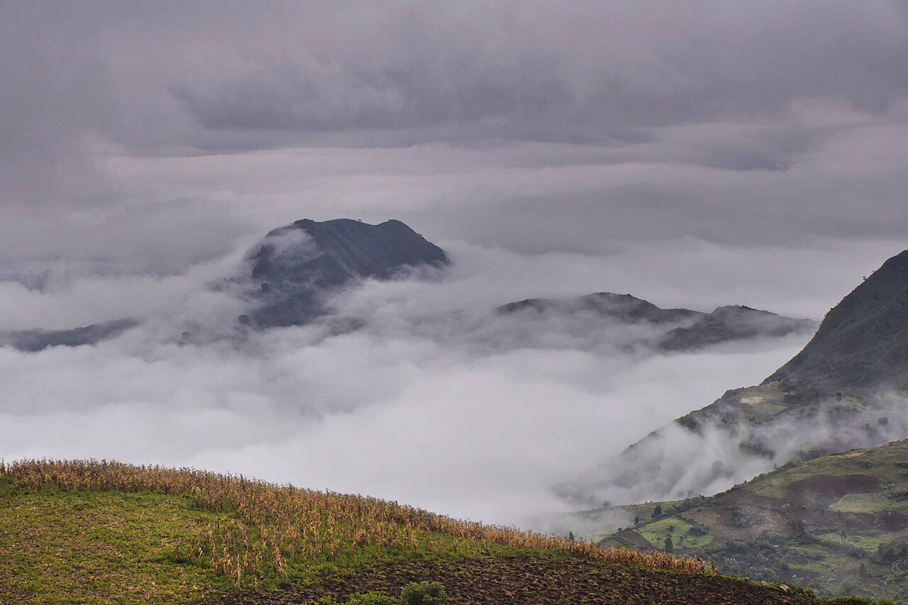
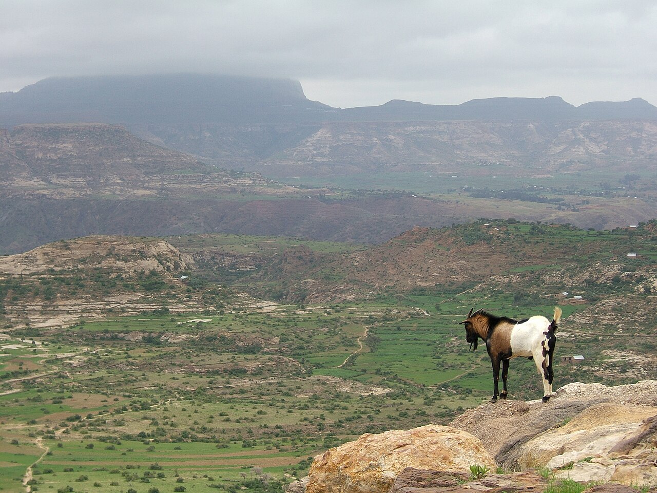
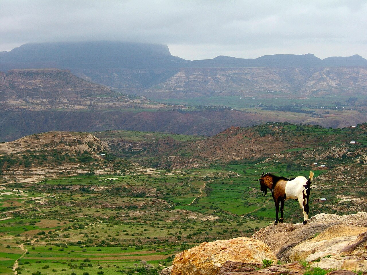
The Ethiopian Highlands, also known as the Abyssinian Highlands, are a rugged mass of mountains and plateaus in the Horn of Africa. They consist of a high central plateau that varies from 1,290 to 3,000 m above sea level, with some 25 mountains whose peaks rise over 4,000 meters, the highest being Ras Dashen at 4,543 meters. The plateau is split diagonally by the Great Rift Valley. A number of rivers cross the plateau, notably the Blue Nile rising from Lake Tana. The highlands are bordered by Eritrea to the north, Djibouti and Somalia to the east, Sudan and South Sudan to the west, and Kenya to the south.
- location
- Northeast Africa (Ethiopia and Eritrea)
- highest_peak
- Ras Dashen (4,550 m)
Lore & Background
The highlands are a clearly marked geographic division, with walls that rise abruptly from the plains on nearly every side. In Eritrea, the eastern wall runs parallel to the Red Sea from Ras Kasar (18° N) to Annesley Bay (15° N), then turns due south into Ethiopia, following the line of 40° E for some 600 km. About 9° N, a break in the wall allows the Awash River to flow eastward. The main range trends southwest, while south of the Awash Valley, another massif rises, sending the Ahmar Mountains east toward the Gulf of Aden. The two chief eastern ranges maintain a parallel course south by west, with a broad upland valley in between containing a series of lakes, to about 3° N. The southern escarpment overlooks the depression holding Lake Turkana and the southern Debub Omo Zone. The western wall, from 6° N to 11° N, is well marked and precipitous. The eastern escarpment has a mean height of 2,100 to 2,400 m, rising almost perpendicularly from the plain in many places. The northern portion lies mainly between 10° and 15° N, consisting of a huge mass of Archaean rocks with a mean height of 2,000 to 2,200 m above sea level, flooded in a deep central depression by Lake Tana. Above the plateau rise several irregular mountain ranges attaining altitudes from 3,700 m to just under 4,600 m. Characteristic of the country are enormous fissures formed by the erosive action of water, creating river valleys and isolated flat-topped hills known as ambas.
Reader's Guide
The Ethiopian Highlands are of immense significance as the source of the Blue Nile, which rises from Lake Tana. The highlands' rivers, including the Tekezé, Abay, and Sobat, flow northwest to the Nile, comprising some 85% of its water. The Tekezé River, the true upper course of the Atbarah, has headwaters in the central tableland and falls from about 2,100 to 750 m, forming part of the border with Eritrea. The Abay, the upper course of the Blue Nile, has its source near Mount Denguiza in the Choqa mountains, flows 110 km nearly due north to the south shore of Lake Tana, then escapes through a deep crevasse, making a great semicircular bend east, south, and northwest down to the plains of Sennar. The highest peaks are found in the Semien and Bale ranges. The Semien Mountains, northeast of Lake Tana, culminate in Ras Dashen at 4,550 m. The Bale Mountains, separated from the larger highlands by the Great Rift Valley, include Tullu Demtu, the second-highest mountain in Ethiopia at 4,377 m, Batu at 4,307 m, Chilalo at 4,036 m, and Mount Kaka at 3,820 m. East of the highlands toward the Red Sea lies a strip of lowland semi-desert, the Ethiopian xeric grasslands and shrublands. The highlands' elevation gives Ethiopia a temperate climate near the equator, and they capture monsoon rains that feed the Nile.
Did You Know?
- The Ethiopian Highlands have some 25 mountains whose peaks rise over 4,000 meters, the highest being Ras Dashen at 4,543 meters.
- The Blue Nile, rising from Lake Tana, contributes about 85% of the Nile's water during the rainy season.
- The Tekezé River, known as the 'Terrible,' rises some 5 meters above its normal level during rains, forming an impassable barrier.
- The highlands feature isolated flat-topped hills called ambas, formed by water erosion over millennia.
- Lake Tana, the source of the Blue Nile, has an area of about 2,800 square kilometers and a depth in some parts of 75 meters.
Geographic Position & the Central Plateau
Ethiopia is located in the Horn of Africa. It is bordered by Eritrea to the north, Djibouti and Somalia to the east, Sudan and South Sudan to the west, and Kenya to the south. Ethiopia has a high central plateau, the Abyssinian Highlands, that varies from 1,290 to 3,000 m above sea level, with some 25 mountains whose peaks rise over 4,000 meters, the highest being Ras Dashen at 4,543 meters. Elevation is generally highest just before the point of descent to the Great Rift Valley, which splits the plateau diagonally. A number of rivers cross the plateau; notably the Blue Nile rising from Lake Tana. The plateau gradually slopes to the lowlands of the Sudan on the west and the Somali-inhabited plains to the east. Ethiopia's westernmost locality is Pibor River opposite the Sudanese village of Denjok. Its easternmost locality lies along the eastern border of Dollo Zone opposite Puntland and Galmudug states.
The Eastern Escarpment & Plateau Walls
The eastern escarpment is the best defined of the outer ranges. It has a mean height of 2,100 to 2,400 m, and in many places rises almost perpendicularly from the plain. In Eritrea, the eastern wall of this plateau runs parallel to the Red Sea from Ras Kasar (18° N) to Annesley Bay (also known as the Bay of Zula) (15° N). It then turns due south into Ethiopia and follows closely the line of 40° E for some 600 km. About 9° N there is a break in the wall, through which the Awash River flows eastward. The main range at this point trends southwest, while south of the Awash Valley, which is some 1,000 m below the level of the mountains, another massif rises in a direct line south. This second range sends a chain (the Ahmar Mountains) eastward toward the Gulf of Aden. The two chief eastern ranges maintain a parallel course south by west, with a broad upland valley in between – in which valley are a series of lakes – to about 3° N, the outer (eastern) spurs of the plateau still keeping along the line of 40° E. The southern escarpment of the plateau is highly irregular, but has a general direction northwest and southeast from 6° N to 3° N. It overlooks the depression in which is Lake Turkana and – east of that lake – the southern Debub Omo Zone. The western wall of the plateau from 6° N to 11° N is well marked and precipitous. North of 11° N the hills turn more to the east and fall more gradually to the East Sudanian savanna plains at their base. On its northern face, the plateau falls in terraces to the level of the eastern Sudan.
Crown Peaks & the Northern-Southern Divide
The highest peaks are found in the Semien and Bale ranges. The Semien Mountains lie northeast of Lake Tana and culminate in the snow-covered peak of Ras Dashen, which has an altitude of 4,550 m. A few kilometers east and north respectively of Ras Dashen are Mounts Biuat and Abba Yared, whose summits are less than 100 meters below that of Ras Dashen. The Bale Mountains are separated from the larger part of the Ethiopian highlands by the Great Rift Valley. The highest peaks of that range include Tullu Demtu, the second-highest mountain in Ethiopia (4,377 m), Batu (4,307 m), Chilalo (4,036 m) and Mount Kaka (3,820 m). Parallel with the eastern escarpment are the heights of Biala, 3,810 m, Mount Abuna Yosef, 4,190 m, and Kollo, 4,300 m, the last-named being southwest of Magdala. Between Lake Tana and the eastern hills are Mounts Guna, 4,210 m, and Uara Sahia, 3,960 m. In the Choqa Mountains of Misraq Gojjam, Mount Choqa (also known as Mount Birhan) attains a height of 4,154 m. Below 10° N, the southern portion of the highlands has more open tableland than the northern portion and fewer lofty peaks. Though there are a few heights between 3,000 and 4,000 m, the majority do not exceed 2,400 m, but the general character of the southern regions is the same as in the north: a much-broken hilly plateau.
Erosion, Fissures & the River Network
Characteristic of the country are the enormous fissures which divide it, formed over time by the erosive action of water. They are the valleys of the rivers, which rising on the uplands or mountain sides, have cut their way to the surrounding lowlands. Some of the valleys are of considerable width; in other cases the opposite walls of the gorges are but two or three hundred meters apart, and fall almost vertically thousands of meters, representing an erosion of many hundred thousand cubic metres of hard rock. One result of the action of the water has been the formation of numerous isolated flat-topped hills or small plateaus, known as ambas, with nearly perpendicular sides. Most of the Ethiopian uplands have a decided slope to the northwest, so that nearly all the large rivers flow in that direction to the Nile, comprising some 85% of its water. Such are the Tekezé River in the north, the Abay in the center, and the Sobat in the south. Another large river is the south-flowing Omo, with 14% of the entire drainage the largest river outside the above-mentioned three main arteries discharging to the west, and by far the main feeder of the endorheic Turkana Basin with Lake Turkana. The rest is carried off by the Awash, which runs out in the saline lacustrine district along the border with Djibouti; by the Shebelle River and the Jubba, which flow southeast through Somalia, though the Shebelle most often fails to reach the Indian Ocean. The Tekezé River, which is the true upper course of the Atbarah River, has its headwaters in the central tableland; and falls from about 2,100 to 750 m in the tremendous crevasse through which it sweeps west, north, forming part of the border with Eritrea, and west again down to the western terraces, where it passes from Ethiopia to Sudan. During the rains the Tekezé rises some 5 m above its normal level, and at this time forms an impassable barrier between the northern and central regions. The Abay – that is, the upper course of the Blue Nile – has its source near Mount Denguiza in the Choqa mountains, around 11°0′N 37°0′E. It first flows for 110 km nearly due north to the south shore of Lake Tana. Tana, which stands 750 to 1,000 m below the normal level of the plateau, has somewhat the physical aspect of a flooded crater. It has an area of about 2,800 square kilometres, and a depth in some parts of 75 m. At the southeast corner the rim of the crater is, as it were, breached by a deep crevasse through which the Abay escapes, and here makes a great semicircular bend like that of the Tekezé, but in the reverse direction – east, south and north-west – down to the plains of Sennar, where it takes the name of Bahr-el-Azrak or Blue Nile.
Gallery
Frequently Asked Questions
Who is Ethiopian Highlands?
The Ethiopian Highlands, also called the Abyssinian Highlands, is a rugged mass of mountains and plateaus in the Horn of Africa spanning parts of Ethiopia and Eritrea. It features a high central plateau ranging from roughly 1,290 to 3,000 meters in elevation, with about 25 peaks climbing past 4,000 meters.
What are Ethiopian Highlands's powers/role?
Nicknamed the 'Roof of Africa,' the highlands are the birthplace of the Blue Nile, which rises from Lake Tana and flows across the plateau. The Great Rift Valley splits the formation diagonally, and numerous rivers traverse its surface.
How does Ethiopian Highlands's story end?
Because the Ethiopian Highlands is a real, ongoing landform rather than a narrative character, it has no plot conclusion. It persists as a permanent geographic feature bordered by Eritrea, Djibouti, Somalia, Sudan, South Sudan, and Kenya, with its landscape still shaped by tectonic and hydrological forces.
Why is Ethiopian Highlands important?
The highlands are central to the Horn of Africa's water systems, ecology, and human history, serving as the headwaters of the Blue Nile and sheltering over 25 peaks above 4,000 meters. Their elevation and rugged terrain have long shaped the cultures, agriculture, and settlement patterns of surrounding nations.
What is the highest peak in Ethiopian Highlands?
Ras Dashen, at roughly 4,543 to 4,550 meters, is the tallest summit in the Ethiopian Highlands and one of Africa's highest points. It stands among approximately 25 mountains in the formation that exceed the 4,000-meter threshold.
More in Plateaus And Plains 1-24
Elsewhere in the Plateaus And Plains universe
Spotted an error? Know more?
This is a living reference — every entry is fact-audited, and reader corrections feed straight into our audit queue. Suggest an edit · See this site's audit record