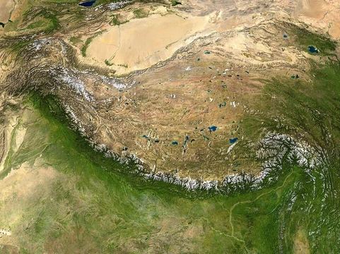
Putorana Plateau
A remote Russian plateau with vast nickel deposits and deep lakes.

Matroskin24 · CC BY-SA 3.0
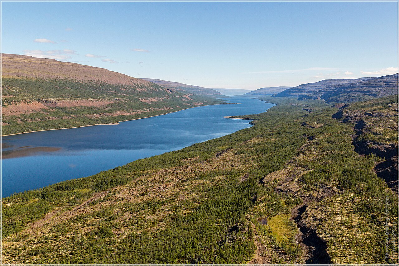
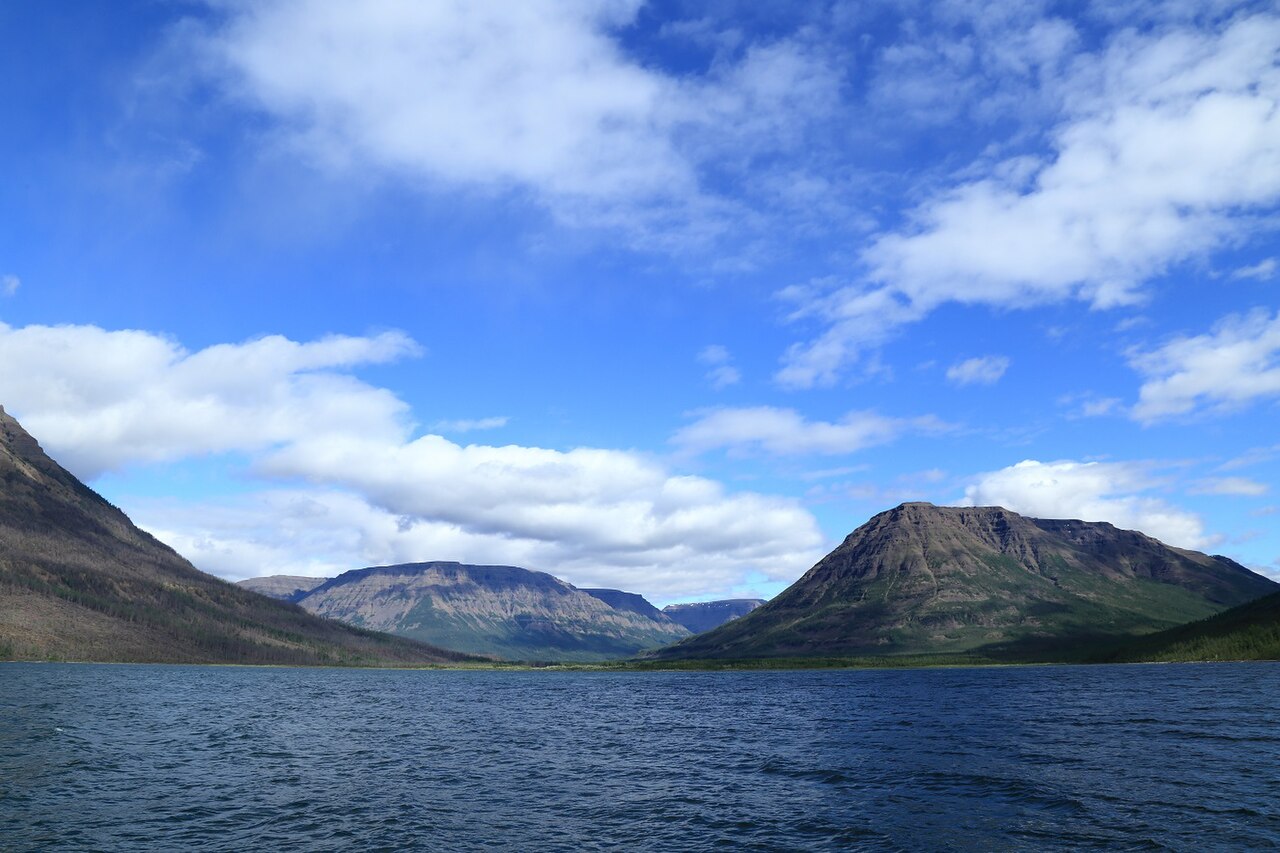
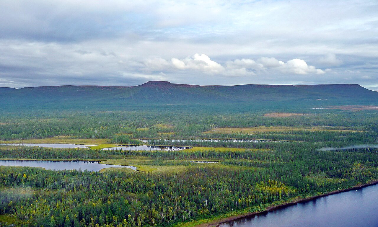
The Putorana Plateau is a mountainous area in Russia, located at the northwestern edge of the Central Siberian Plateau. It is a large massif or plateau crossed by mountain ranges.
- location
- Russia, east of the Yenisei River valley, between 67° and 70° N latitude
- number_of_lakes
- over 25,000
- major_mineral_resources
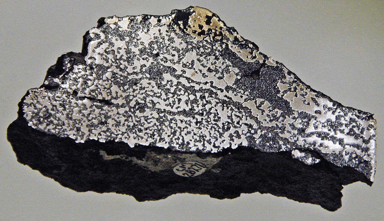
- nickel, copper, iron ores, coal, basalt, silicates, apatites, perovskites
Lore & Background
The Putorana Plateau is a high-lying plateau crossed by mountain ranges at the northwestern edge of the Central Siberian Plateau. Talnikovy Waterfall is reputedly one of the highest waterfalls in Asia.
Reader's Guide
The plateau also holds some of the world's largest nickel deposits, along with other minerals such as copper, iron ores, and coal. The region's harsh subarctic climate, with long, severely cold winters and short, cool summers, supports the world's largest herd of wild reindeer and snow sheep, which the reserve was established to protect.
Did You Know?
- The Putorana Plateau contains some of the largest known nickel deposits in the world.
- The plateau sits within the Siberian Traps, a large igneous province formed by a massive eruption 250 million years ago that coincided with the Permian–Triassic extinction event.
Position Within the Siberian Plateau System
The Putorana Plateau is one of six named plateaus that together form the Central Siberian Plateau, alongside the Anabar, Lena, Lena-Angara, Tunguska, and Vilyuy Plateaus. This central plateau is itself one of three major landform zones that structure the entire North Asian region, the others being the West Siberian Plain to the west and the Verhoyansk-Chukotka collision zone to the east. The plateau also belongs to the broader Angara Shield complex, which encompasses the Taymyr Peninsula, the East and North Siberian coastal lowlands, and the Central Yakutian Lowland. All of this sits within a region spanning roughly 13.1 million square kilometres, making it the largest subregion of Asia by area and accounting for nearly 29 percent of the continent's total land. Its borders stretch from the Arctic Ocean in the north to the Central and East Asian lands in the south, from Eastern Europe in the west to the Pacific and North America in the east.
Tectonic Heritage and the Siberian Traps
Beneath the Putorana Plateau lies a geological story stretching back hundreds of millions of years. The plateau rests on the Eurasian Plate, which dominates the topography of nearly all of North Asia, with only the far eastern reaches sitting on the North American, Amurian, and Okhotsk Plates. The central portion of this vast region is identified as a large igneous province known as the Siberian Traps, the product of a massive volcanic eruption roughly 250 million years ago. That event coincided with the Permian-Triassic extinction event, a pivotal moment in Earth's biological history. The Putorana Plateau, as a component of this central plateau zone, sits within the broader tectonic landscape shaped by that ancient upheaval. The geomorphology of North Asia as a whole remains imperfectly understood, even though its deposits and mountain ranges are well catalogued. Additionally, the Eurasian Plate itself has pivoted to compensate for new ocean floor created in the Siberian basin, a tectonic process that has influenced the positioning of the landmasses over deep geological time.
Arctic Exposure and Open Terrain
Because the Putorana Plateau sits within a landscape that lacks the kind of continuous mountain barriers found in many other parts of the world, it is fully exposed to the unimpeded flow of cold Arctic air. In North Asia, there are no major mountain chains to block polar air currents from sweeping southward across the plains of Siberia and Turkestan. This means the plateau, as part of the Central Siberian Plateau, experiences the direct influence of Arctic Ocean air masses that can travel unobstructed from the northern coast all the way across the vast interior. The region's sheer scale amplifies this effect: spanning approximately 13.1 million square kilometres, North Asia represents 8.8 percent of all land on Earth. The plateau's position within this enormous expanse of plains and plateaus means that weather systems originating over the Arctic can reach it with minimal attenuation. This open, barrier-free topography is a defining characteristic of the plateau's environment, distinguishing it from more sheltered highland regions elsewhere on the continent and contributing to the climatic conditions that have shaped both its ecology and its sparse human settlement patterns over millennia.
Human Presence in a Vast, Sparse Landscape
The Putorana Plateau exists within a region whose human story is defined less by density than by depth of time. Hominins first set foot in North Asia roughly 100,000 years ago during the Late Pleistocene, and modern humans with West Eurasian origins are confirmed to have arrived by about 45,000 years ago. The broader region was home to peoples from numerous language families, including the Ainu, Chukotko-Kamchatkan, Mongolic, Nivkh, Tungusic, Turkic, Uralic, Yeniseian, Yukaghir, and Eskaleut groups. During the first millennium CE, the Göktürks held sway over southern Siberia, while the early second millennium saw the Mongol Empire and its successor states extend their rule across the region. The Khanate of Sibir stood as one of the last independent Turkic states before Russia conquered it in the sixteenth century, initiating a wave of European emigration that reshaped the demographic landscape. Today, over 85 percent of North Asia's roughly 37 million inhabitants are of European descent, while Indigenous peoples account for only about 5 percent, making the region the least populated subregion of Asia at just 0.74 percent of the continent's total population.
Gallery
Frequently Asked Questions
Who is Putorana Plateau?
Putorana Plateau is a rugged, mountain-crossed massif in northern Russia, sitting just east of the Yenisei River valley between 67° and 70° N latitude. It occupies the northwestern edge of the much larger Central Siberian Plateau and is one of the most remote elevated landforms in the country.
What are Putorana Plateau's powers/role?
The plateau is famous for concentrating some of the largest known nickel ore bodies on Earth, along with substantial copper, iron, coal, and rare silicate deposits. It also supports a staggering network of over 25,000 deep lakes, together forming Russia's second-biggest fresh-water reservoir after Lake Baikal.
How does Putorana Plateau's story end?
As a real geological formation the plateau has no narrative ending; it persists as an ancient basalt-and-granite landform still being reshaped by glacial erosion and slow tectonic uplift. In the fan-encyclopedia arc it closes out the 25-27 sequence as the final remote, mineral-rich entry before the series moves on.
Why is Putorana Plateau important?
Economically, it anchors a major portion of global nickel supply within a single, hard-to-access Siberian region. Ecologically, its thousands of deep glacial lakes hold the second-largest volume of fresh water in Russia, making the plateau a keystone of the northern hydrological system.
Where does Putorana Plateau appear in the series?
It is featured in the Plateaus And Plains run as entries 25 through 27, positioned as a high-latitude, outer-frontier counterpart to the more temperate plains covered in earlier chapters. Its placement at the northwestern fringe of the Central Siberian Plateau gives it a distinct 'edge-of-the-map' role in the geography.
More in Plateaus And Plains 25-27
Related in Plateaus And Plains
Links follow this subject's own source article.
Elsewhere in the Plateaus And Plains universe
Spotted an error? Know more?
This is a living reference — every entry is fact-audited, and reader corrections feed straight into our audit queue. Suggest an edit · See this site's audit record